


Key features of Wildland Fire Map:
-Detailed Wildland fire incident information from Wildlandfire.com, The Hotlist!
-MODIS Hotspot Detection from the NASA GOES WEST R Satellite
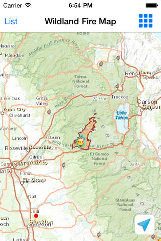
-Fire maps with custom overlays including Severe Weather Warnings and
NEXRAD Radar.
-Active fire perimeter mapping.
-Powered by Esri.
Wildland Fire Map provides critical incident information for persons affected by wildfire.
The app provides life-saving information for firefighters, responders, and residents of fire prone areas including current weather conditions at the scene of major incidents. As information becomes available, Wildland Fire Map provides perimeter tracking and map imagery.
This app is aimed at anyone requiring more information about Wildland fire incidents.
Disclaimers: Information in this app is updated as incident information becomes available and after the daily National Morning Situation Report. Fire perimeter imagery not available for every fire.